
🤗 Model | 📄 Paper | 📓 Tutorial Notebook | 🌎 Web Demo
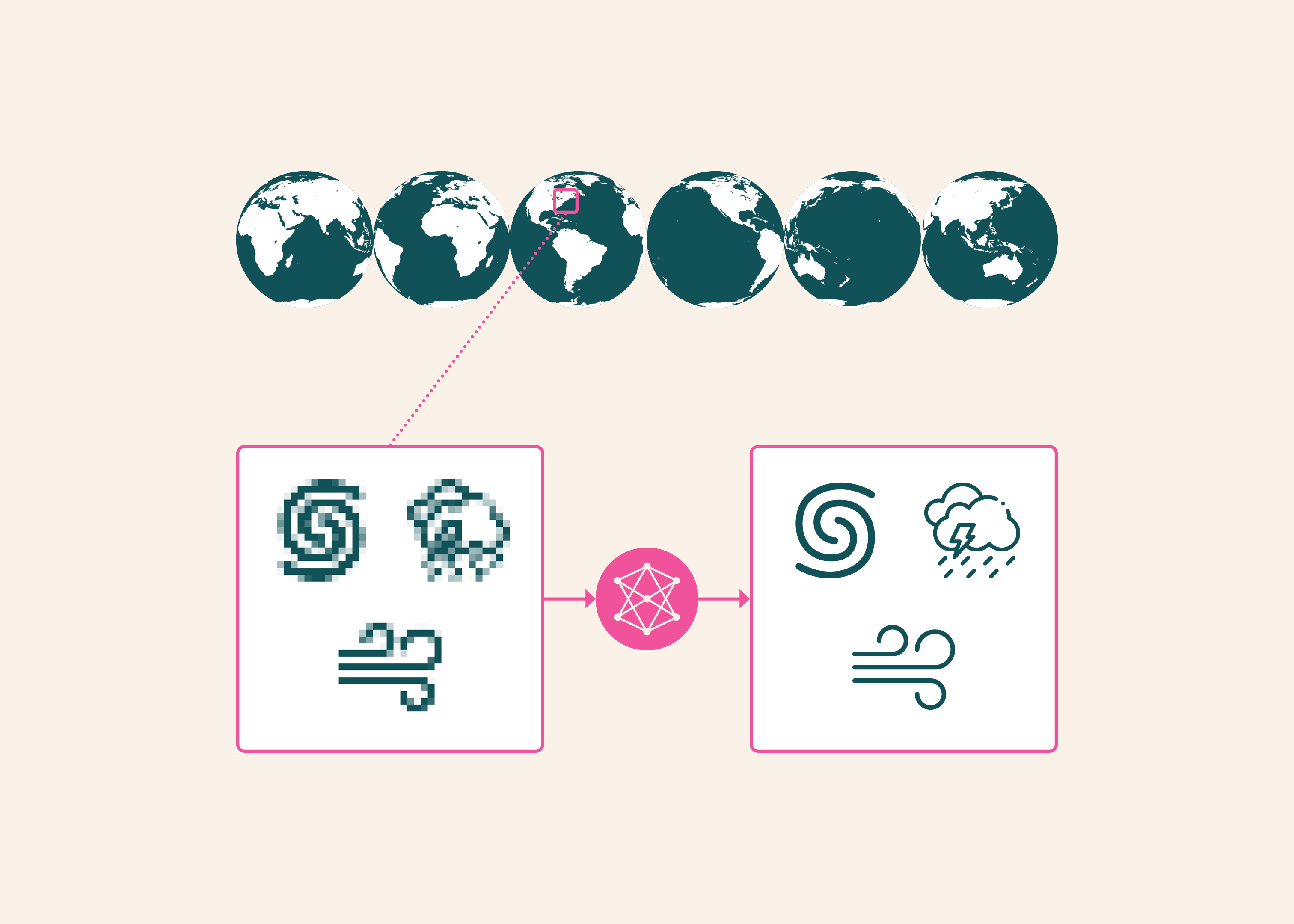
We are excited to introduce HiRO-ACEv2, the latest upgrade to the High Resolution Output Ai2 Climate Emulator (HiRO-ACE) system. HiROv2 accurately reproduces extremely rare heavy precipitation, strong winds, and extreme pressure events, while generating global 3 km climate data at roughly 1/300th the cost of X-SHiELD—a high-resolution global atmospheric model capable of explicitly resolving storms and other fine-scale weather phenomena.
First introduced in early 2026, HiRO-ACE consists of two components: ACE, an AI model running at a coarser 100 km resolution, and HiRO, a model that refines these coarse-grained outputs down to 3 km details. The primary advancement in HiRO-ACEv2 is the brand-new downscaling model, HiROv2, which can now: 1) simultaneously predict multiple high-resolution variable fields rather than just precipitation, capturing a broader range of extreme weather; and 2) significantly enhance predictive skill for extreme events.
Our core focus with HiRO-ACEv2 has been accurately simulating extreme events. Improvements to HiROv2’s training pipeline enhance its ability to reproduce extreme precipitation, wind speeds, and atmospheric pressure. When conditioned on coarse-grained X-SHiELD data, its high-resolution statistics match the target simulation within 3%, even for one-in-a-million extreme events. In addition, it accurately estimates total tropical cyclone energy—including for storms never seen during training—and generates hurricanes with realistic eyes and rainbands, though the distribution of wind speeds and pressure around the eye remains slightly less symmetric compared to X-SHiELD. HiROv2 also realistically captures downslope windstorms.
We also trained a new version of ACE for this system. Over a 10-year simulation run, the hurricanes, mean climate patterns, and overall distributions of precipitation, wind, and pressure it produces align closely with X-SHiELD. This demonstrates that ACE’s coarse simulations provide a solid foundation for generating long-term, high-resolution climate data.
Combining HiROv2 with ACE, we generated a full year of global 3 km data. Even though HiRO took its inputs from ACE’s independent simulation runs rather than true X-SHiELD data, its statistical metrics remain remarkably close to X-SHiELD. Over a 10-year run, HiRO-ACEv2 produced hurricane energies comparable to X-SHiELD over the same period, and snapshots from this run showcased a wide array of extreme events closely mirroring those in X-SHiELD.
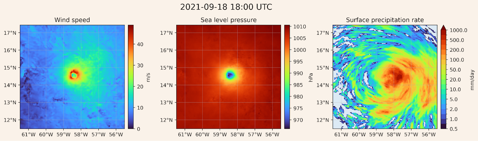
An example of an intense North Atlantic hurricane generated during a 10-year HiRO-ACEv2 simulation.
Overall, HiRO-ACEv2 offers researchers a flexible, cost-effective way to generate multiple realizations of high-resolution precipitation, wind, and surface pressure data for extreme events over timescales of a decade or more. Generating global high-resolution data with it costs roughly 300 times less than running X-SHiELD. If data is only needed for specific regions, savings can increase by more than another factor of 100, depending on the domain size. We are also actively developing a streamlined version of HiROv2, which aims to boost speed by more than an additional 10x.
Substantial work remains ahead: because HiRO learned from X-SHiELD, it is currently tailored only to versions of ACE tuned to X-SHiELD. Consequently, it cannot yet generate high-resolution data for alternative climate scenarios—such as a warmer future climate—or historical records from datasets like ERA5. Moving forward, we plan to train on new X-SHiELD datasets (including one simulating a 4°C warmer world) to adapt the system to varied climate regimes. We also intend to add output variables such as near-surface air temperature and snow/ice, opening up broader applications like snowpack forecasting.
Visualizing and Using HiRO Outputs
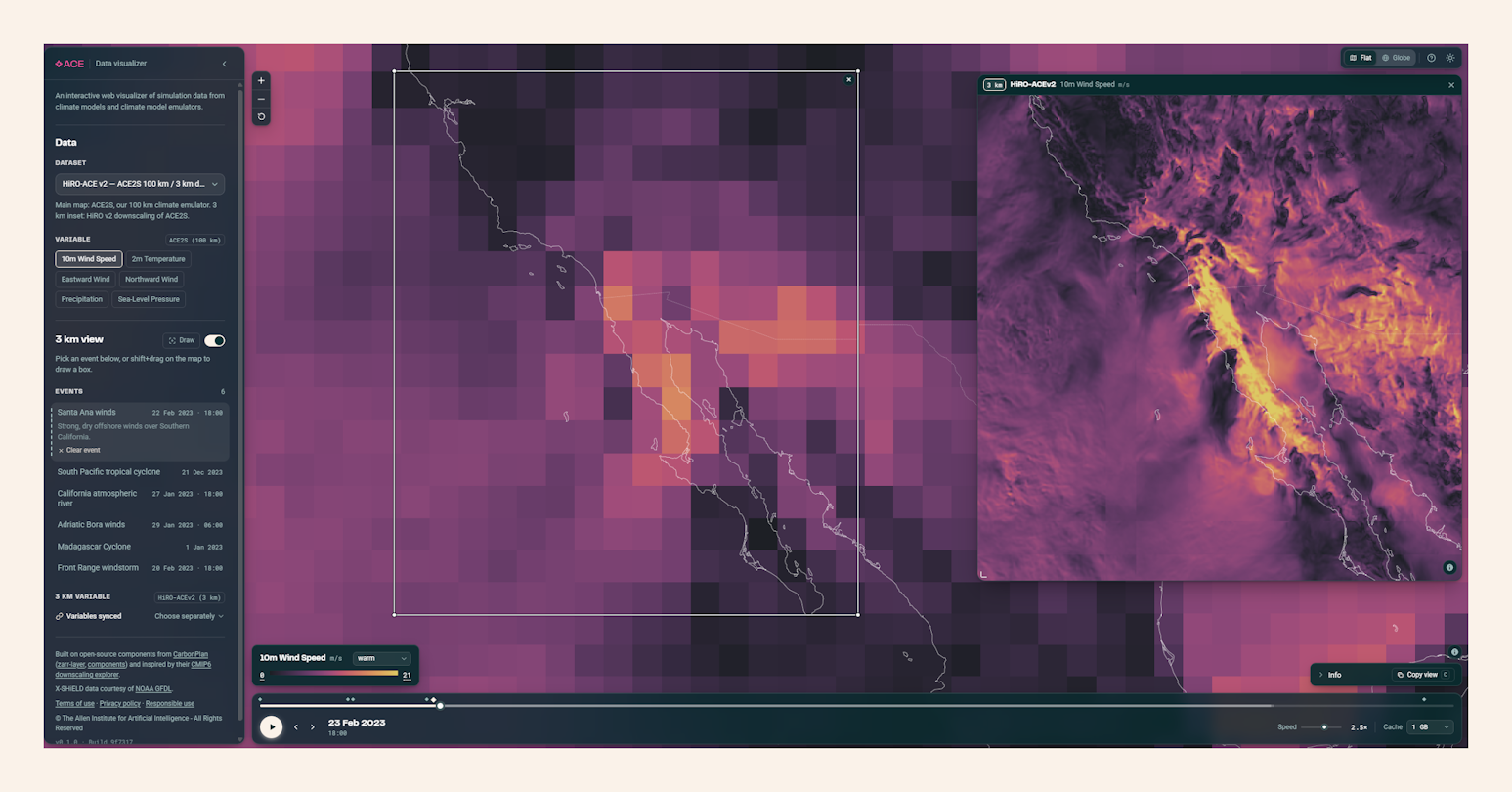
Simulated 10-meter wind speed over Baja California in the ACE data visualizer: the main panel shows 100 km resolution ACE2, while the inset shows 3 km resolution HiRO-ACEv2.
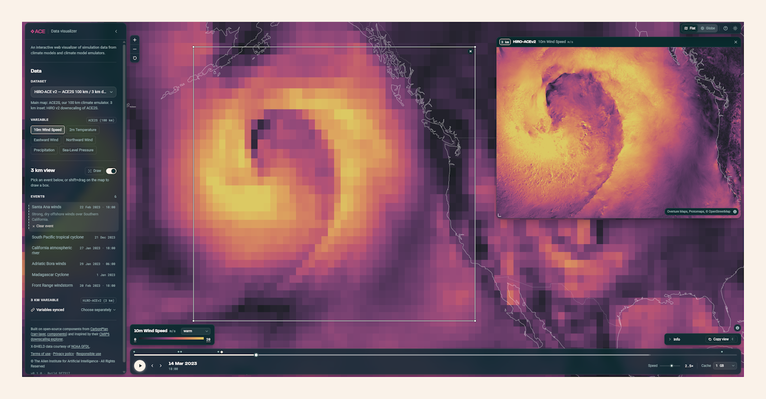
A simulated storm in the Northeast Pacific from the ACE data visualizer. The main panel displays 10-meter wind speed at 100 km resolution; the 3 km HiRO-ACEv2 inset highlights the finer internal structure of the storm.
To let users explore HiRO’s outputs without running any inference, we built an interactive web demo that displays pre-generated precipitation, wind, and sea-level pressure outputs from both HiROv1 and HiROv2 alongside the X-SHiELD simulations they were trained on. This demo complements the quantitative comparisons in our technical report: it offers an immediate, visual sense of the outputs and lets users zoom into regions of interest to evaluate performance firsthand.
For deeper analysis, the models are now available for download, and our tutorial notebook walks step-by-step through running them.